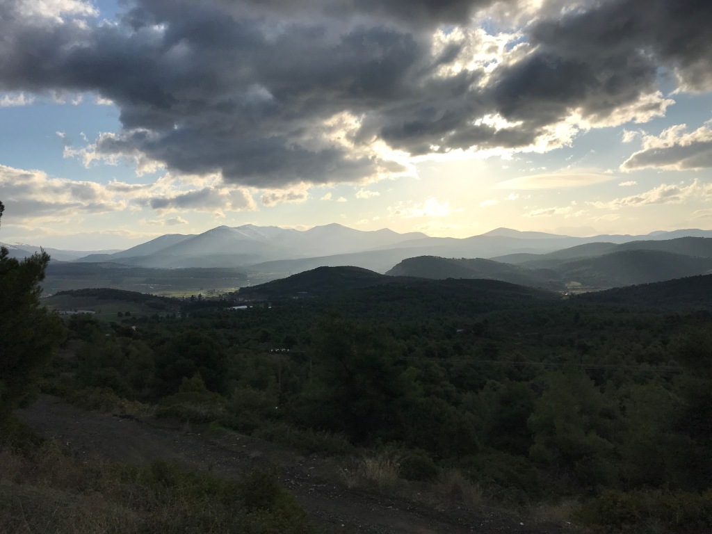
After an exhausting season at work, I needed a break that would allow me to catch up on some much needed exercise, as well as permit me to engage in some quiet reflection while enjoying the peace of the outdoors. Last year, I was talking to someone about walks in the UK and they mentioned Snowdonia. I’d been to Aberystwyth before, some years ago, which is right at the Southern border of Snowdonia National Park. Sophie and I just went to Brecon Beacon, which proved to be a far more exciting hike than we had expected. So I was really eager for Snowdonia.

Choose your path wisely
I decided to take the Snowdonia Way, and in hindsight, the sheer distance calculations were a mistake. There would have been no issue clearing the 18-24 miles daily I needed to do within my timeframe, but I made a few errors in terms of navigability, daylight constraints, and load-bearing abilities. Check the official site for some useful recommendations.
I learned a couple important things:
- As you get farther north, one must operate with significantly less daylight, even in October. Mid-October, the day is actually 7:30am sunrise and about a 6:20pm sunset. This really limits the amount of dawdling (or pub wallowing) and more significantly the amount of getting lost you can allow
- Don’t overestimate your fitness or underestimate the weight of your pack when determining the distance you can clear in a day
- Even with complete survey ordinance maps, many of the paths in Wales are overgrown, or aren’t official — they may literally be sheep paths. This means you must factor in at least an hour for getting lost
Preparing for a walk in Snowdonia
Looking back toward Mac, at this point I had already sweat through my clothes.
I chose my own formulation of the path based on the Snowdonia Way path, and I tended to choose the more rugged bits but also the less popular parts of the national park to the south. These were beautiful, but I regret not spending more days in the top toward the coast. Especially the Slate path and the mountains around there were worth exploring in more depth. Whatever way you go, be careful in calculating the distance and read multiple sources. Also, be prepared in terms of supplies, be sure to bring:
- First aid kit (you really might need it) – £10
- Emergency survival blanket – £5
- Sturdy collapsable rain poncho – £10
- Optional, rain pants (for sideways rain and slips) – £10
- Waterproof cover for your pack, I use a sturdy REI pack with a removable cover I bought three years ago – £150
- Dry socks / enough change of clothes, and if possible spare pair of shoes – make sure they will stay dry
- Whistle/flashlight (torch) combo – £8
- Heavy, waterproof coat – between £40-£120
- Waterproof boots – £30-£85
- Ordinance maps – £20
Can’t stress the importance, though I didn’t use half of these things — I came close to needing them on several occasions, and the other things were lifesavers. We’ve also needed these on our other walks in Wales and other remote parts of the world, so worth the investment.
Day 1: A dangerous navigational error – Machynlleth to Dolgellau
My hike began from Mac, early in the morning. Leaving from the village and heading northeast, it started out with a bit of a steep climb right away. (I stayed at the Wynnstay – do not recommend it, very rude staff and way overpriced. So book early to find something else!)

Heading northeast toward Foel Gach — first leg of the journey. Ordinance maps are helpful for context, but not super accurate in Wales.
Though I carefully marked out my path, due to some of the difficulties with finding way markers I did lose track at some point. Initially, I followed the Coastal Path, which ascends quickly through several pastures and is marked with blue seashore markers. It quickly winds sharply to the east toward the sea. Instead, I opted to take the forest service path which forks into multiple roads and a path that descends down into the valley. I took the fork to the right, which led through a really cinematically creepy wood.

You can see the post for the Coastal Marker, looking back towards Mac.
Eventually, I followed the roads, which don’t appear accurately on the map. I chose the road because it was firm ground and not soggy, which meant that I ran less risk of getting damp (I had already gotten damp from the overgrown path where branches reach out and drench you).

Followed this path through the dark, wet woods until the road forked. Take the fork right.
From following the road, after a while (2 kilometers or so) I caught some kind of nature path for the Dyfi Biosphere. Before that the trail winds up near a stone house and I stayed left, even with the latitude of Centre for Alternative Energy on the map. After that, it really leads straight up and over the mountain.

Road leads up the mountain on a little specially-marked path
After a while the trail becomes faint, though at first you easily find the ladders over the walls. First, you climb up a very steep tree-lined path, with really thick short pine tress. Eventually, this turns into an even steeper scramble up through the pastures not only very steep, but muddy.

The fog suddenly rolled in and made it more difficult to navigate
I kept climbing, and the views were great. The forest path leads to another path along a fence. Follow the fence across a number of sheepfolds. Eventually, it rises up, higher and higher until you get a really good view of the surrounding land.

Follow the fence along the pastures, it is pretty strenuous going because the path keeps leading off into smaller paths where sheep have created their own ways
To the west you can see directly to the sea and to the east you get a great view of the mountains which increase in altitude to the north. Very lovely scenery. However, this is where I lost the trail, I climbed up through several pastures following the trail and it turned into the road. With no way markers, I followed the road up and to the right (that being the direction I needed to go to get down to the valley to Abergynolwyn).

I climbed up this ridge, it’s much steeper than it looks, the path leads down and to the left after you cross the gate but then it quickly turns into a road which I took to the right
At some point, I lost my way and wound up on the wrong hill. Unable (and perhaps unwilling) to turn around, I pushed on, able to see a road nearby that ran parallel. There is a system of forest roads down there, that if I reached could easily get me to Abergynolwyn. For the sake of time, I decided to navigate down the mountain through the brush. This was a huge (and incredibly dangerous) mistake. All of the stands of trees in those woods have been re-grown, but I didn’t realise that the land is highly unstable because it was piled with some old rotted and decaying pieces of timber. So, as I navigated down through the the thickly growing trees, I had to use my hands to keep the brush out of my face. My hands were really torn up by the time I reached the bottom. Also, to navigate I had to keep my head low, I didn’t realise how steep the drop was and how wet the hillside was. In short, I am lucky to have survived that stupid gambit.
When I did make it to the bottom, my waterproof boots were completely soaked. I squished and squelched my way back and forth on the logging roads, which didn’t appear correctly on my map, for about 2 hours, in the end walking 5 kilometers just to get to the hill path that led down to Abergynolwyn. By the time I made it down into the town, it was 2 o’clock, leaving me less than the recommended 5 hours to do the Cadair Idris walk, but also in completely soaked boots. Even if I swapped out my boots for my tennis shoes and took up the trail immediately (presuming no more navigational errors), it would have been a tough journey, leaving me no time to appreciate the mountain. Instead, I had a nice pint in the great little pub in Abergynolwyn with lunch and called a taxi to Dolgellau (OUCH!), I surmised it wouldn’t do me much good to start day 2 with trenchfoot or get stuck in the dark somewhere. As a result, I missed Cadair Idris. SAD! But I did get a bit of time to relax in my hotel room and the charming little town of Dolgellau, which is comprised mainly of slate buildings.
Day 2: An unexpected bus journey, and more frustrations with incomplete maps

Sheepies living in abandoned human houses
On day two, the frustration from failing to complete my journey the first day only compounded my resolve to power through and finish the walk. However, what I didn’t realise was just how steep the valleys were and just how far I had signed up to walk! I went back later and calculated, it was 18 miles from Dolgellau to Ffestiniog. That’s as the crow flies, but I was not only traveling on indirect and (sometimes) difficult to locate paths, but I was also carrying around 40 pounds on my back (which slows you down).
In the morning, my intention was to walk the whole way. I left early (with no breakfast, thanks stupid rugby match), leaving Dolgellau via the bridge to the north of town. After crossing, it’s easy to follow the road up the steep hill until you come to a sign for a golf course where you can turn left. This road descends somewhat and here you see a sign for a footpath which you follow up over a small bridge. Traveling a long a busy road for a minute, you soon connect with the footpath which goes through the little town of Llanelltyd.

Head out of Dolgellau over the bridge
From here, you’ll start a very gradual climb up overlooking the valley. I took this path for sometime and it winds through the woods and offers beautiful views of the valley below. My original plan was to strike out to the west and travel across the mountains. However, by 11:35 in the morning I had only come about 12% of the distance for the day and I got turned around in a boggy field for about 45 minutes. Before long, I had already stepped in a deep puddle, so soaking wet and discouraged, I did a quick desperate Google search for public transport.
About half a mile down the hill was a bus stop. I had about 22 minutes to get down a pretty steep hill, or I would miss the next bus which was about four hours later. Shivering in my sweat-drenched clothes, I made a mad dash down the hill through a small country park and came out of a rusty gate by someone’s cottage. I hustled up the road and made the bus (which was about 7 minutes late). In hindsight, it was a good choice, soon after I was on the bus it started to really rain.

I took the bus to Maentwrog which meant I still had a few miles to go to Ffestiniog. It wasn’t a particularly pleasant hike in the rain. So I clambered back down, went back to where I had been unable to find the path and tried harder. Eventually, across a busy section of road, I sighted the footpath sign. Completely damp at this point, I trundled through the woods, up a steep hill and through some fields until I made it to Y Pengwern, the loveliest place I stayed the whole trip.
Arriving soaked and exhausted, this was definitely the low point in my trip, but finally the next day — things were looking up.
Day 3: Slate trail is really a sheep trail
On the third day, I was heading from Ffestiniog to Nant Gwyant, I had finally had the sense to set myself a realistic target.

Piles and piles of Slate line the trail up through the valley
I had a lovely breakfast in Ffestiniog at Y Pengwern. In order to really get a jump on the day (which I thought I needed), I decided to grab a bus up to Blenau Ffestiniog, rather than walk. This was a good choice, it was not a scenic bit, and this placed me in a good position to make great time for the day. The bus dropped me at the mountain railroad station in the center of town. From there, just a bit of walking in town allowed me to catch public footpath. The trail immediately ascended up, around the side of the mountain, through a sheep pasture and down through another small village, Tanygrisiau, then connecting with the well-marked Slate trail.

The Slate trail was really neat. Following the road up a steep hill, You walk past derelict housing for the slate miners, as well as massive piles and piles of slate. There’s an old slate church, a slate farmhouse, even a slate watermill — very cool. Also, once you rise up out of the ‘Valley of the Slate’, you find yourself encountering incredible views, but a real lack of trail markers. I lost about 35 minutes looking for the trail, until I was lucky enough to encounter a friendly old farmer fella. I showed him my map, and he pointed over the mountain.
“Is that the trail…?” I asked.
“Not trail per se… more like a sheep path” He answered, “Just head that way.”
So I did. Fortunately, you quickly encounter a few mountain lakes that provide a bit of locational context, otherwise, it’s just a steep climb up a harsh and boggy plateau. Eventually, you come to a series of really incredible mountain lakes. Remote and isolated, because there’s no trail you’ve got to be careful. I lost the trail for a bit and as a result my shoes got very, very wet. That really makes the rest of your walk less pleasant.

The ‘Slate Valley’ is beautiful, but stay on the road as the area is heavily mined and there are deep sinkholes
It also gets a lot colder up top, so be sure not to wear all your layers on the way up, or you sweat, get soaked, and then freeze. Also crucial is paying attention to your compass and overlay on your map.
Important tip: Sometimes in Wales, the trails don’t look like trails but steep drop-offs. They might still be trails.
From there, it’s an up and down slog across the marshes, choose your trail carefully because there are a few electric fences. The mountain lakes provide a lovely place to stop and have a snack, if you can find a dry place. There’s one with a little island in it. Cute.

Navigating the swampy sheepfolds, a middle plateau half-way down to the valley, you can see the Watkin path, which heads through the pass up toward Snowdon (my tomorrow path)
Finally arrived, with soaking feet to Nant Gwynant — this is it the next day on my way up

It doesn’t look like a steep waterfall from here, but it drops off quick. I almost got stuck on a ledge but managed to get down

Through the woods to the YHA Victorian house, this is easy to catch from the road once you’ve navigated the disastrously muddy sheepfolds
I lost the trail, despite my best efforts, and had to climb down a waterfall. In hindsight not the best choice of the day, there were some steep drops, very hazardous mossy slippery bits, and I almost got stuck on a ledge because I was too tired to climb back up with my 40lb pack. But I made it down to the huge lake, and then proceeded to walk around, hopped the wall, said ‘hi’ to the sheep and started trying to figure out the convoluted path down through some farmer’s badly marked pasture. Eventually, I found the marked path, but by mistake, and took it through some really deep dark woods, emerging at the bottom of the hill, a quick climb to the YHA. Don’t get there before 5pm, or you’ll be bored and frozen, no check-in until then.
Important tip: Ordinance survey maps in Wales aren’t 100% accurate, sometimes you have to go your own way.
Day 4: Finally, some real damn mountains
Day 4 was awesome. The best day easily. Though day 3 went pretty smoothly, I arrived a bit too early and still lost the track a bit. On day 4, I only really got lost once, and it wasn’t lost as much as just confused by how insanely steep some of the paths were.
It was finally time to climb Snowdon, I was afraid I wouldn’t have enough time to make it up Snowdon, down the other side and up the Glyders. I was wrong, as another guest and the hostel guy assured me, there was plenty of time to make the distance. The reason for this is that the paths in this northern area of the park are well-marked (except for one or two really scary spots) and the Watkin Path and Pyg Track are essentially stone steps the whole way. For me, this meant running up the mountain because I was worried about not making great time.
So, bright and early at 6am, I grabbed some continental breakfast, a few strips of bacon and headed out for the cutoff that heads over the stream and connects with the Watkin path. It’s not super easy to find, but fortunately you know generally where you’re headed, up.

Follow a pedestrian footbridge through some fields, hop a stone wall (since the path disappears) and you’ll see two trails leading up into the pass, I recommend staying left – that means fording the stream
After hopping some rocks in the stream and risking your downfall bright and early, it’s a straight rapid climb on clearly marked stone stairs, you’ll also see a stone signpost for the Watkin Path. The path is pretty clear, but very easy to lose your way once the mist really comes in. I stayed on the path for most of the way, but I did lose it at some point.

Once you climb up the pass, you find yourself in a long valley, several paths branch off — stick with Watkin Path

Looking back down at the path — elevation rises pretty quickly, I had sweat through my clothes at this point, but this is also where it really starts to climb

The path gets really steep as you approach the ridge, it gets harder not to lost in foggy conditions
In fact, after I strayed from the path, I ended up climbing (almost free-hand), and at this point I took my pack off because I was essentially dangling off the mountain. My backup water bottle came loose and before I could grab it I saw it go tumbling into the mist, and then heard it fall thousands of feet down the steep slope below. This was very scary, and almost immediately afterward, exhausted from going straight up the rock face, I saw a figure emerge in the mist. For a moment, I thought I was already dead… then I realised it was a rock…

It’s the grim reaper! Pretty scary moment.

It’s not the grim reaper… It’s Watkin
After I scrambled a bit, I came to the top of the ridge. It’s clearly marked on the map and it’s easy to know based on your compass bearings when you’ve actually intersected with it. Scramble along it and it will incline steeply just before you collide with the main ridgeway path, a perfectly perpendicular stone path. Follow it up, don’t get freaked out by the eerie silence if it’s foggy. Then before you know it, you’ve made it.

Here’s the building at the summit where the railway terminates. You can get a not-great coffee and a snack in there.
I made it in astounding time, just under three and a half hours, but that’s because I ran up, I was eager to get to the top and didn’t pause for views because it was foggy. I was, unfortunately, unable to get any view on top because of the fog, but that’s the gamble. I still had the excitement of the climb though. I didn’t linger long, just enough time to catch my breath and grab a bad coffee in the mountain top cafe / rail station.
My original idea was to take the Crib Goch, which is the ‘dragon’s back’ style trail that traverses the ridge above the Pyg track, and down toward the Glyders. Instead, given my harrowing climb up in the fog and subsequent exhaustion, and the long way yet to go, I opted for the Pyg track. In the end, this was a great choice. In the fog, the top track views would have been wasted and it would have been dangerous going for no reward.
A short distance down the Pyg track, you’ll begin to see gorgeous views back up toward Snowdon, and heading out toward the Glyders. There is a view of the huge, beautiful reservoir that you get to enjoy all the way down the track.

The track splits into the Miner’s track, where you can walk down by the water, or you can stay on the Pyg track
As soon as the track levels out you immediately head up, when you crest the hill, follow the sign for Pen-y-Pass, around the peak, you catch the opposite side down for sweeping views of the valley. It is a stone path, with stairs cut in at different levels. Again, I took it pretty fast, making it to Pen-y-Pass by noon for a five and a half hour up and down from start of the path. Not too bad all-in-all.

Path heads up and to the left of that peak
Once I was down in the valley, I saw the Pen-y-Pass Hostel and regretted not staying there, it’s big with some food options and in a beautiful area. Fortunately though I was making good time, so I stopped off to buy a few replacement waters and a Lucozade to replenish some electrolytes. Good choice, the climb up was hard.

Looking down the pass, just before heading down toward the road and YHA lodge
Just to the left of the Hostel, you’ll see a trail that climbs up to the range behind. This is the trail I took, but I really recommend taking one that’s a bit further down the road, as it’s easier to find, better marked, and branches directly off the road. You’ll also, hopefully, then manage to stay dryer than I did. Instead, I lost the trail around Llyn Cwmfynnon and ended up getting soaked in the marsh that lies between there and the only traversable path. It’s there, but it’s a steep one. On the way up, I met a man preparing to hand glide off the top of the hill. I asked him for directions, he suggested to get to Idwal Cottage, my final destination, I needed to take the Miner’s track. He mentioned it was a bit of a scramble. Keep left when I got to the top of the mountain, he suggested. Then one path headed up the Glyders, where you can climb over the top of Glyder Fawr, or head east or west along the range.
I opted to take the Miner’s track down from the top, but under-estimated how hard it would be to find in the fog.

The view of Snowdon and Pen-y-Pass from the top. On the right side you can see where the path winds down to Pen-y-Pass.
Once I got up top, the views were great. You can see right back to Snowdon which was still covered in fog. However, once I got up to the top, the lovely view soon vanished in an equally thick ambush of fog.
The temperature also dropped quickly as the cloud cover rolled in. It was also marshy up there. Before long, even on the trail, I stepped into deep puddles. My boots were soaked and my pants up to my waist were covered in damp bog water.
Soon, I was having difficulty navigating. Whipping out the compass (on my iPhone), I was able to determine based on the location of the lake, where the Miner’s track should be. However, the steep decline looked like it just dropped right off the side of the cliff. That’s not a trail, I thought, panicking a bit and wondering if it was meant for actual harness climbing instead.
It doesn’t look steep from this perspective, but it was pretty scary. Once you slide down a bit, you get your feet.
In reality, it essentially does drop off the cliff. I took off my pack, because in the wind I was worried I would get blown over the side, and climbed to the edge on my belly. There, below, I could see the beginnings of a trail heading off into the rocky side of Glyder Fawr. It looked barely like anything, but once I retrieved my pack, I slinked down against the rock.
It’s about a five foot drop, which looks steep, but gradually leads to a muddy sort of funnel-like path, scrambling and dropping you toward an evened out rock-lined track. In my fatigued state, I had to be careful because it was a sharp drop on the right side, though down a rocky slope, it would be easy to hurt oneself.
Follow that path back up through that pass and you’ll come to a wall fence crossover. From there, you’ll see the beautiful lake below. To the right of that lake (and not on the map), is a carefully cut stone stairway leading all the way down to Idwal Cottage. The other side of the wall is a great spot for a quick rest and maybe a snack because the climb down is arduous.
It was a tough trek and I made some mistakes, but overall I loved it and at the end it felt like a great accomplishment. I estimate I walked around 60 miles in all and if you’re looking for a challenging but enjoyable walk in Wales — go for it.
-Brian
https://www.instagram.com/p/B3rIl8ZJy9u/

Well cut stone path leading down to Idwal Cottage where I concluded my journey